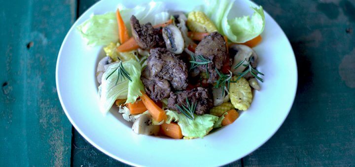
Warm Chicken Liver Salad
We love chicken livers but having it in our salads wasn’t something I had ever thought of. So remember I told you guys we have started on with some healthy drinks early morning,...
We love chicken livers but having it in our salads wasn’t something I had ever thought of. So remember I told you guys we have started on with some healthy drinks early morning,...
Ash gourd pineapple ginger cooler though might sound the weirdest of combos ever,but trust me this is one of the most healthiest and simplest drink you could ever have. Remember the carrot apple mint...
Chorizo banana stem stir fry is my way of keeping the indulgent balanced and healthy. We use banana stem a lot in our cuisine. It has a lot health benefits. The juice of...
Here I am back again, god knows how many times I use this line hoping to be back for real but then I go missing. I haven’t been cooking much either and I am...
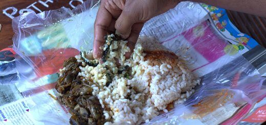
Pothichoru Series 1- Kallumakaya koonu thoran and Pavakka pachadi is something new that I am experimenting with on the blog for few reasons in particular and it all ties back to few conversations I...
I am back after a long social media detox. I must say, after a point, I lost touch with blogging, social media and the weaning sort of built me to become a stronger individual....
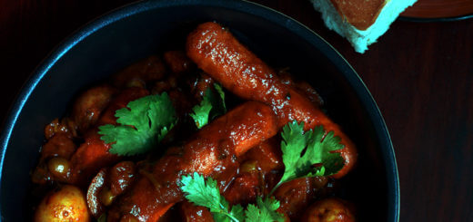
This recipe is quite dear to the Indian Diaspora, homegrown in the US, UK or Middle East. Sausage curry with baby potatoes was the easiest dish that my mom pulled off when dad brought...